
Day 25 West Newton to Confluence Pennsylvania 51 miles
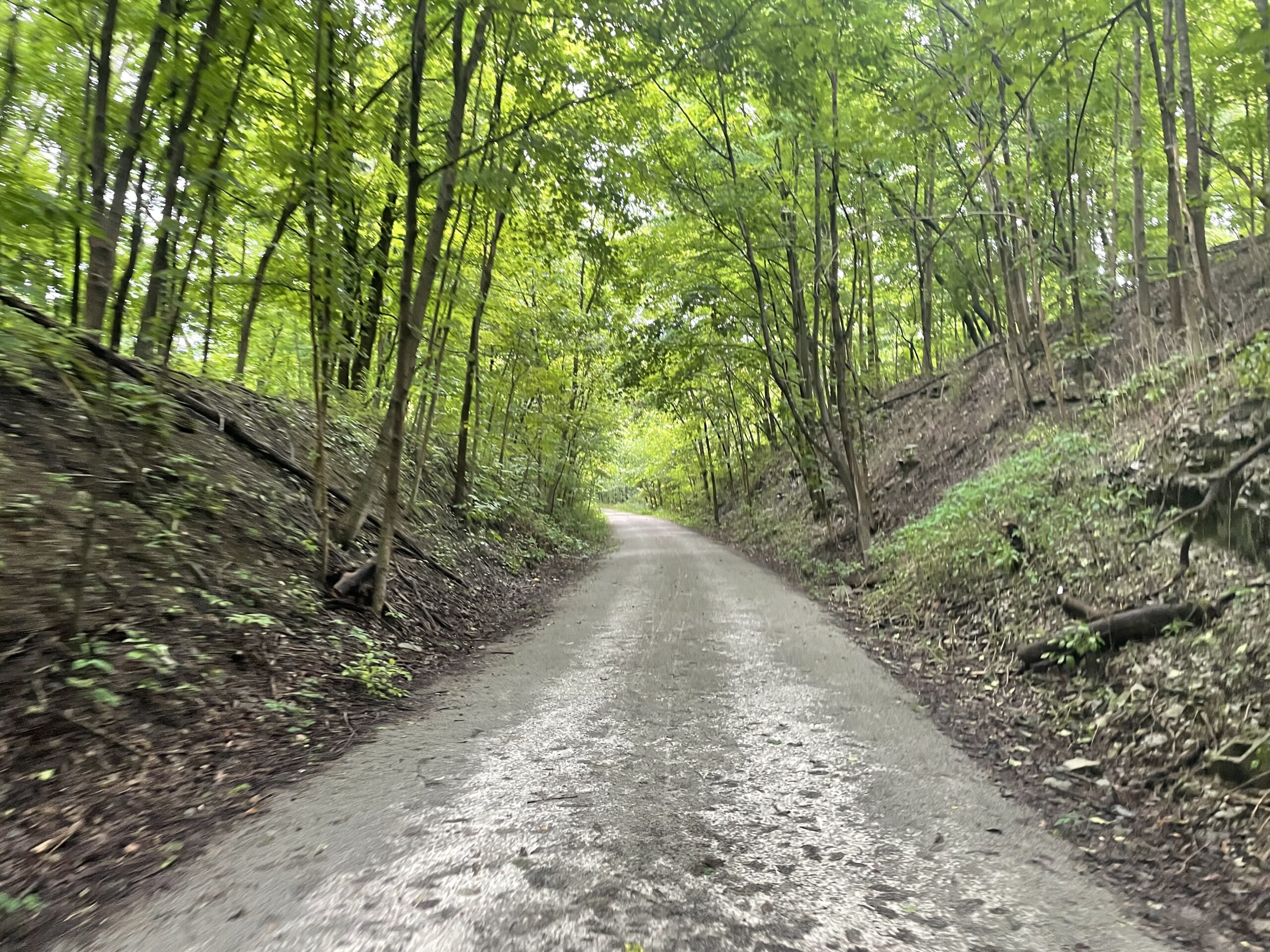
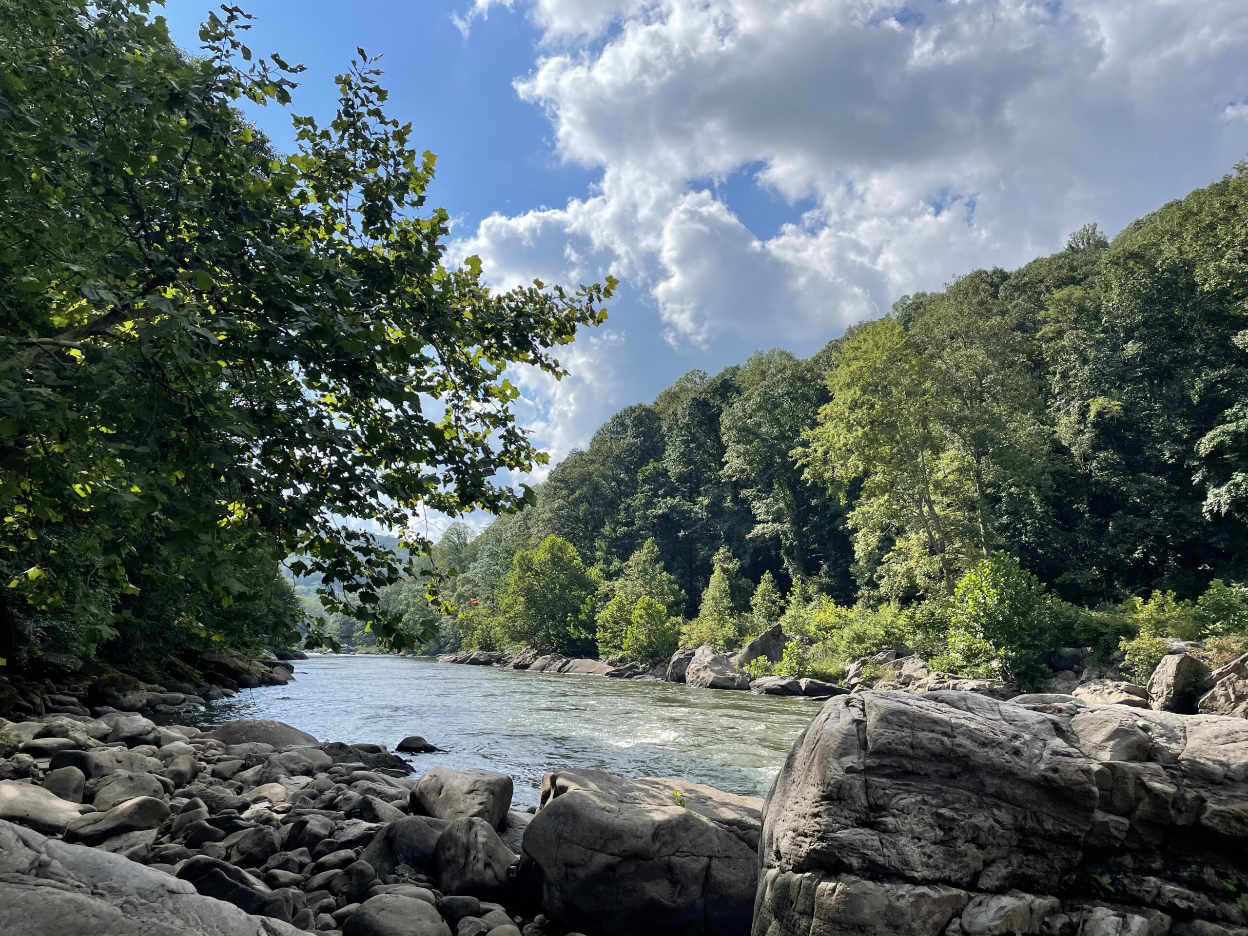
I slept well and except for a flurry of air raid sirens that roused me out for a look at 6 am, I slept in. I took my time getting out the door around 10 and knowing I had a relatively short day all on paths, my legs felt a bit sluggish. It’s amazing how mental this is. When you know I have a big day ahead I rise early and my legs respond. There isn’t a choice. After cycling for awhile I shook off the rust and enjoyed the ride next to the beautiful river. Upstream it had become a beautiful, wide, clear river with a good mix of rapids and slack water and I had a great view through the trees. The GAP Trail is wide, smooth and well maintained and in many parts, away from the cities I was mostly riding alone. I took more time to take breaks and took an extended lunch in Connellsville. I arrived at Confluence at 6 pm and had a nice dinner at a restaurant and then took a hiker/biker site at the campground.
Sixty or Eighty miles a day doesn’t seem like much. During my normal course of business back in Colorado I routinely go over 100 miles a day without leaving my direct vicinity. But most of what we do looks like the old Family Circus cartoons where the direct path between two points turns out to be just an intersecting curl of a path and you end up at the end of the day where you began. On a bike tour, or any road trip for that matter, your progress is linear and cumulative. The progress you made today is added to all of the previous days. And, after awhile, some substantial progress has been made. The quote on the main page of this website by J.R.R. Tolkien sums it up “Little by little, one travels far.” It’s starting to feel that way more and more.
Day 24 Steubenville Ohio to West Newton Pennsylvania. 81.5 miles
I wasn’t sure what this day would be like, so I was a little nervous as I headed out of the steel and brick of a carcass of a town that is Steubenville. It had rained most of the night and I left early in a damp fog. When I arrived at the old metal decked bridge across the Ohio River there weren’t any other cars coming, so I made a cautious break for it. Avoiding the steps that I had descended the prior afternoon. While on the bridge three cars passed me and while they went by I had to stop and lean as far as I could to the right to give them enough room to proceed. The wet metal deck felt a bit like ice and I rode accordingly and thankfully made it to the other end and back into West Virginia.
There were three ways to get to the Panhandle Trail and I took the middle route. Thankfully it avoided the highways, and after a few miles of steep climbing I found myself deposited at the very beginning of the Panhandle Trail. Little did I know at that point but I had just finished riding on roads for my U.S. portion of my trip. Within 8 miles I had cycled in three states and had been deposited in the woods on a divided two-track path in the quiet of the woods. Soon the dirt turned to smooth pavement and I was on my way!
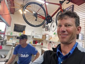 One of my main tasks for the day was to get my rear cassette (the gear sprockets on the back wheel) replaced. I had a new chain put on in Ohio but we didn’t replace the cassette. It had become apparent that I needed one. I had checked a number of bike shops along the way but none had the part I needed. I called ahead in the south Pittsburgh suburbs and found a bike shop with the right part, I put it on hold and planned to visit them in the afternoon. It was off route and I was not looking forward to the busy suburban traffic. At 11 am while cycling along the Montour Trail (I had changed trails) a bike shop / ice cream parkour appeared right on the trail like a mirage in the desert. I stopped in and asked about the part and was told “yes, we have two, but our mechanic won’t be in for an hour”. I got an ice cream cone, caught up on my journal and called the other shop telling them I wouldn’t be visiting that day. At 1 pm I rolled back on the path with my bike in good repair, my legs rested and my phone charged.
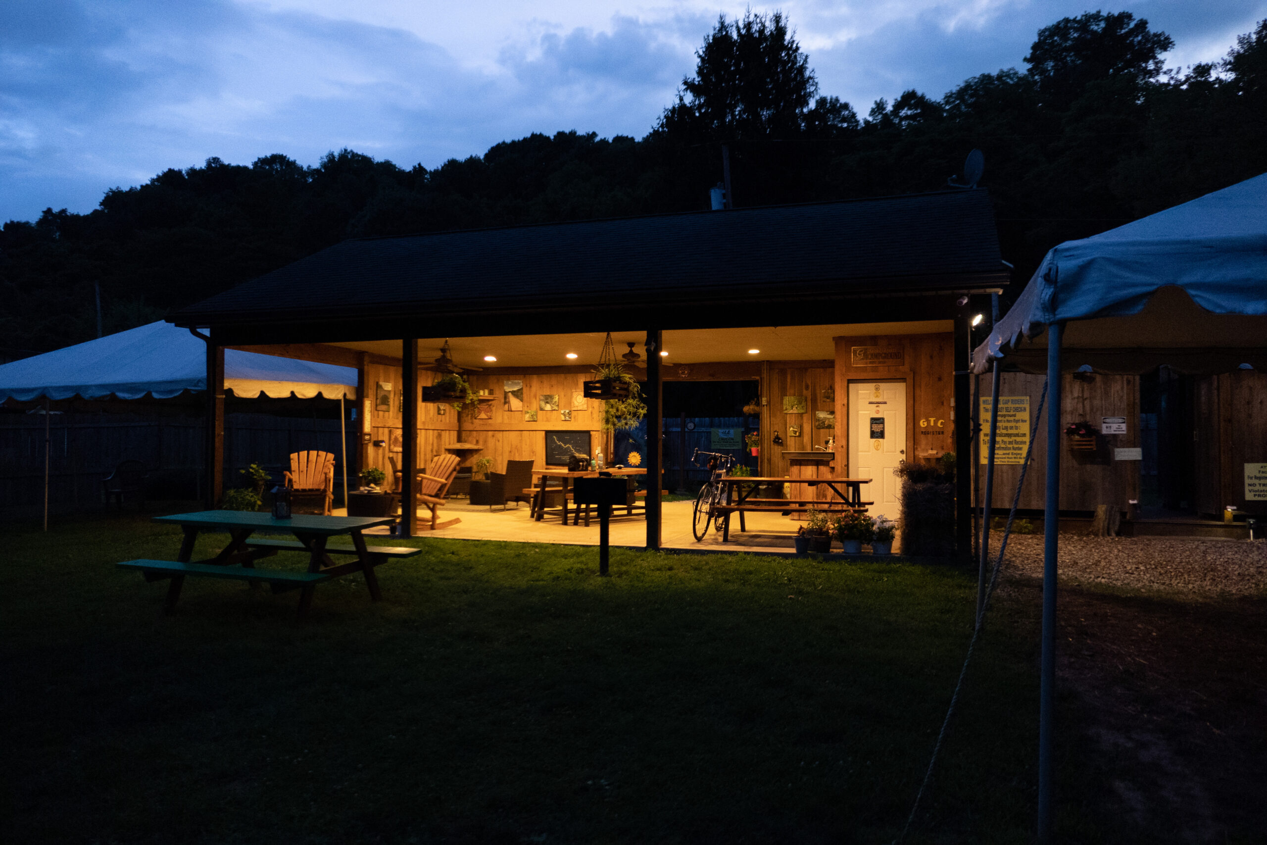
By late afternoon I had made the connection to the Great Allegheny Passage Trail through the steel town of McKeesport Pennsylvania on the Monongalhela River. After a few wrong turns I found the correct side of the Youghiogheny River and headed upstream of this tributary. It was 4 pm and I sat down to finally look ahead to where I might stay. The website www.bikecando.com is a great guide to the mileages and services along this and the C&O Trail ahead. I found a campsite with good reviews 15 miles ahead and knew, even at the end of a long day, that I could make it that far. I was so pleasantly surprised to find my private campground with a beautiful pavillion, zen like outdoor showers, a kitchen and a nice place to put my tent. It turned out that I was the only guest that night and I was completely refreshed and a bit relieved when I thought about the days ahead on this rail trail path.
Day 26 Confluence Pennsylvania to Cumberland Maryland 65 miles
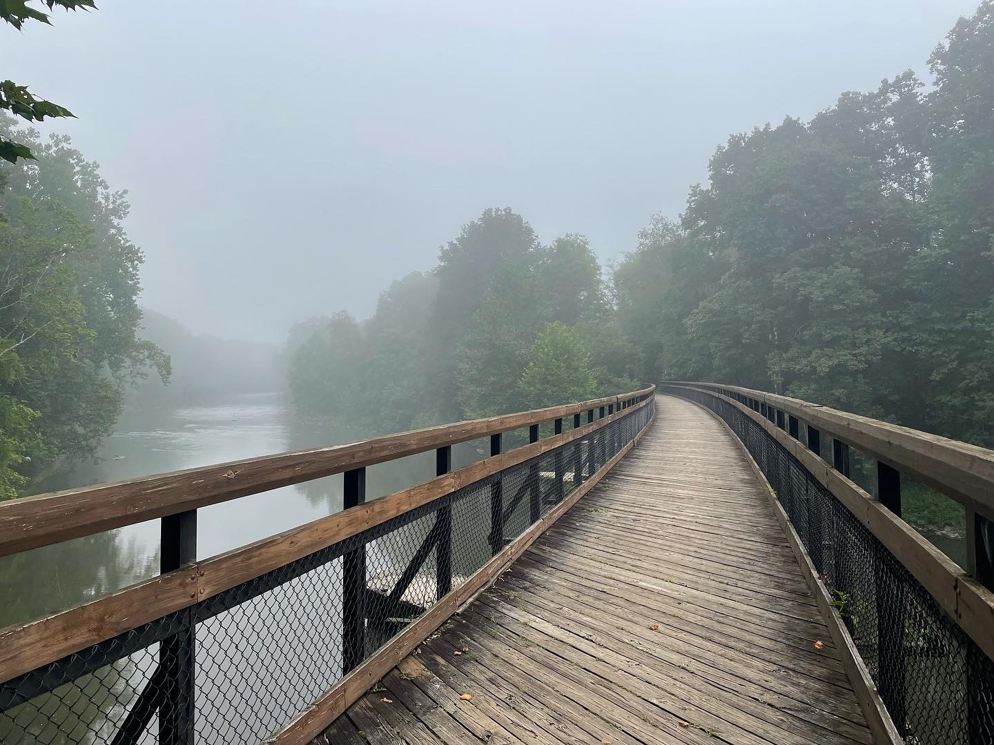
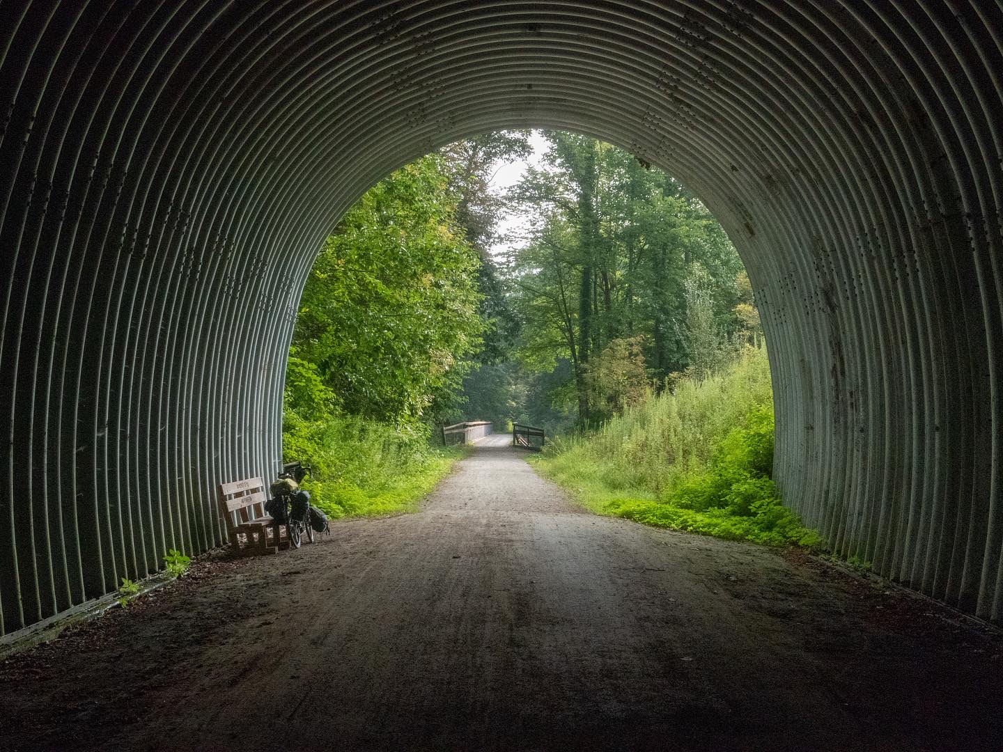
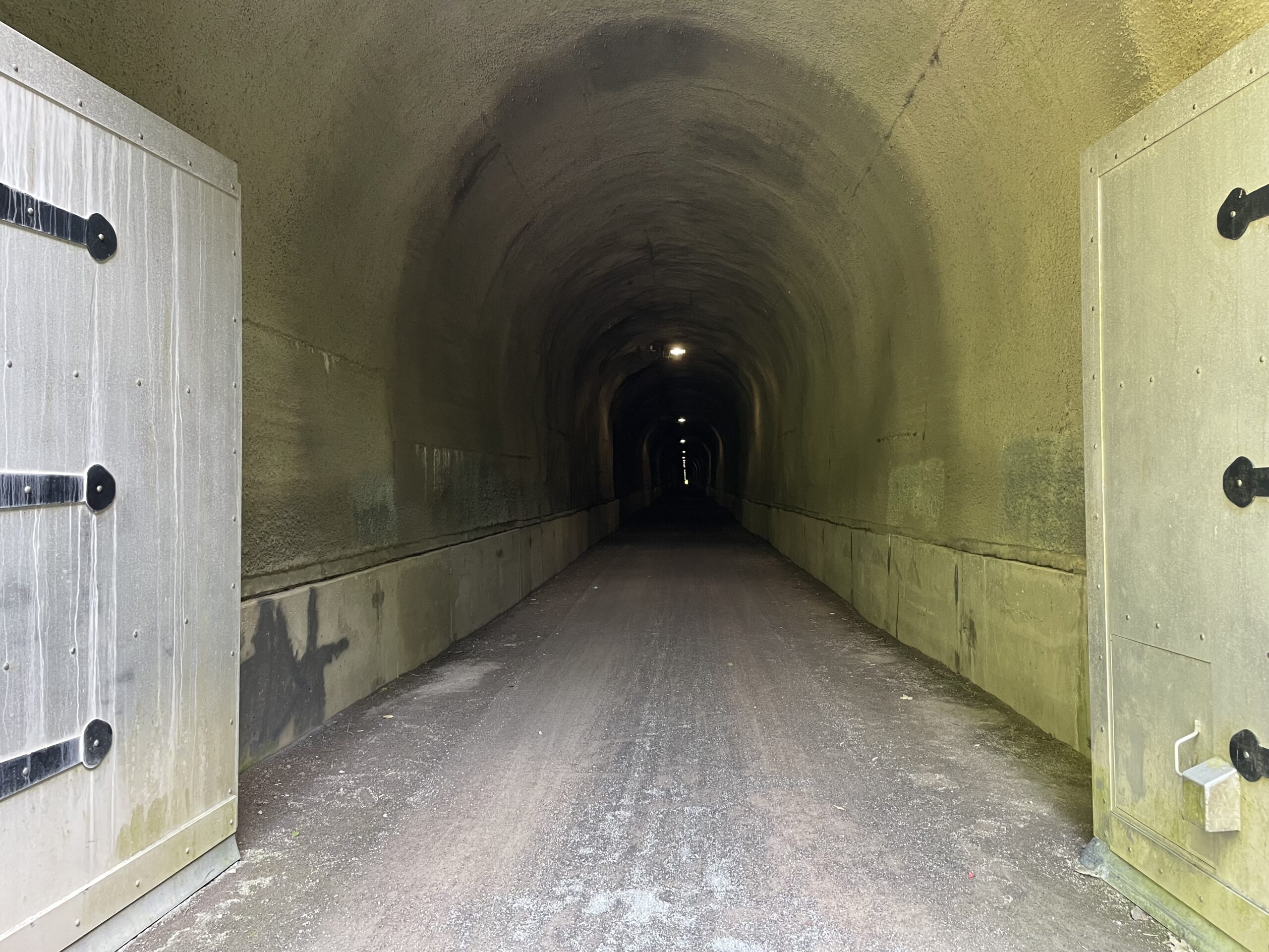
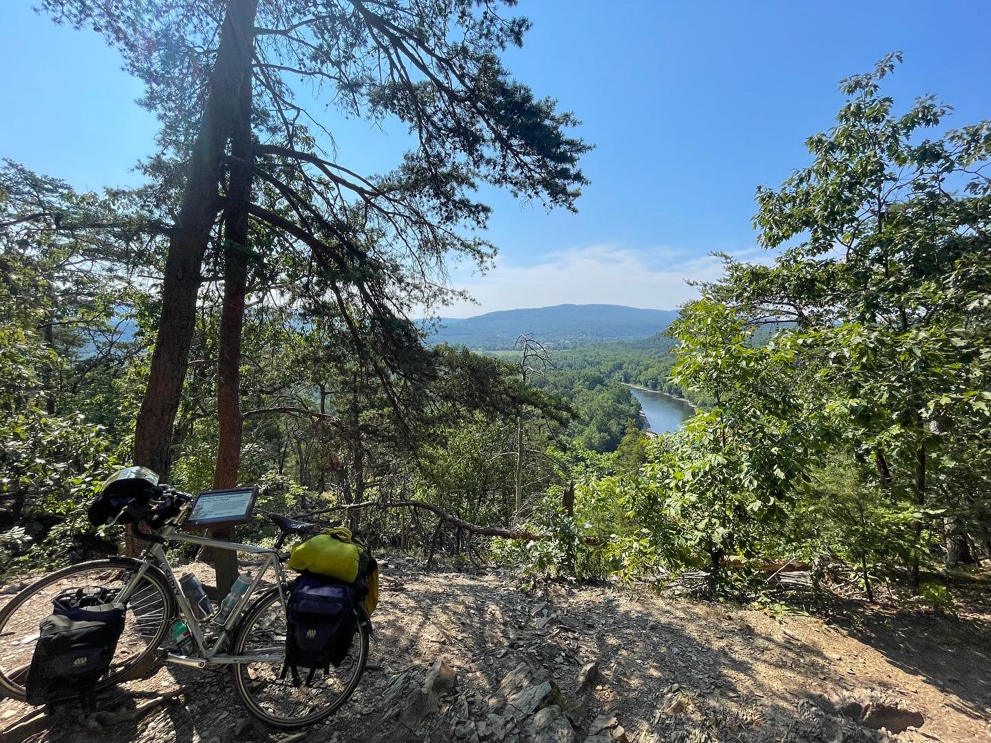
I was up early and really enjoyed my day of easy riding. Two-thirds of the day was uphill and then I had a nice downhill run after reaching the Eastern Divide. The trail went over a number of scenic bridges and a few long tunnels. One tunnel was over 3,000 feet long and the opposite portal was a tiny spot in the distance as I entered in. On the trails, I didn’t have to worry about traffic and therefore, I found myself passing the time listening to my headphones, audio books, religious lessons and music was a good way to pass the time as I rode through the trees.
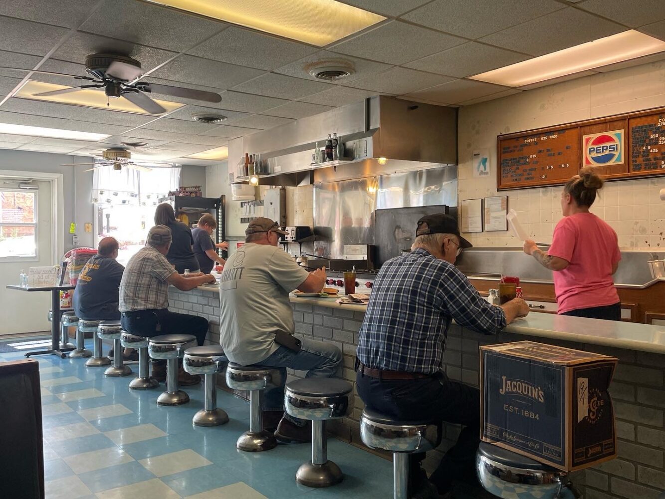
I stopped in Meyersville and had lunch in a great little diner. Here is how I define great in this context: round counter stools occupied by local old guys having pie after their sandwich; one short order cook easily filling orders in plain view of everyone; four other who were waitresses/bookkeepers/cashiers and were talking the talking the entire time and having a good time; hamburgers were $2.75 and the lunch special was meatloaf, green beans and mashed potatoes. I opted for pancakes and sausage and followed it up with a piece of coconut crème pie. My favorite lunch of my entire trip!
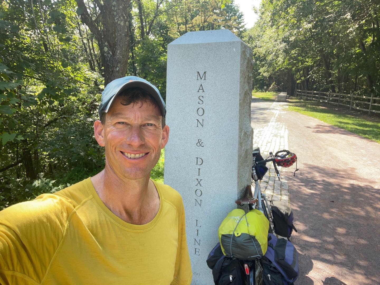
After crossing the divide, the views opened up and the little towns reminded me of New England. I then quickly crossed the Mason and Dixon Line and into Maryland. There was a nice exhibit at the line and I learned more about the land dispute between the Calvert’s and the Penn’s which was solved by two surveyors brought over from England, Mr. Mason and Mr. Dixon. Both families lost their vast new world land holdings just fifteen years later at the conclusion of the American Revolutionary War, but the line remains, both symbolic and between states.
It was a lovely downhill ride into Cumberland where I went to the store and then decided to get a quick bite before continuing on. Cumberland is a crossroads and this is where I left the Great Allegheny Passage a former railroad and started down the Chesapeake and Ohio Canal Towpath Trail (C&O Trail). My first few miles down the path gave me a good indication that the trail conditions were going to be much different. Instead of a wide, well maintained path, I bumped into my campsite on a skinny single track.
Day 27 Cumberland to Hancock Maryland. 58 miles
The campsite last night wasn’t one of the best that I have had. I arrived close to 7 pm and another couple, whom I had met earlier in the day, were camping in the same spot. They had already claimed the picnic table and since I had already eaten I didn’t really need it. So, I set my tent up and to avoid the bugs, I just got into my tent and wrote in my journal. It turned out that sleep didn’t come easily. The campsite was situated between a train switching yard and a quarry and both were busy until about 1 am.
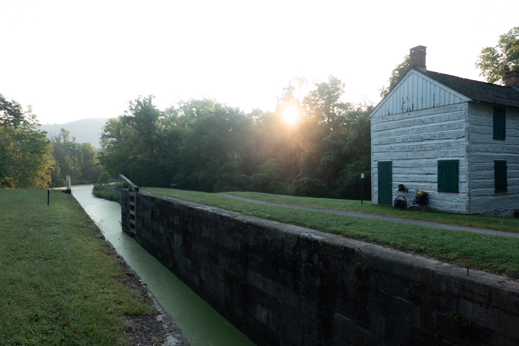
I woke up early and left without making breakfast. I stopped in a 10 miles or so at one of the canal locks which almost always have the green and white lock masters home right next to it. The lock master was always on duty ready to keep the flow of traffic moving up and down the canal. There are 74 locks on the canal between Washington D.C. and Cumberland Maryland and it is approximately 185 miles long. The canal was a way to transport the coal from West Virginia and Pennsylvania to the Atlantic Seaboard. Construction began in 1828 but wasn’t completed until 1850, a few years after the railroad had made the connection. So, in the end it was a great idea that never quite met its full potential. Much of the canal is now dry and is being taken over by the forest. But in some places both the canal and the tow path are easy to picture as they once were.
I stopped again mid-morning to fill up my water bottles in Paw Paw WV before tackling a detour that required me to push my bike up and down a mountain. The Paw Paw Tunnel was closed for construction and it was a sweaty 40 minute hike up and down. Like you are most likely, I was picturing a railroad tunnel through a mountain, but this is a canal through a tunnel with an adjacent tow path. What an engineering project this whole canal was!
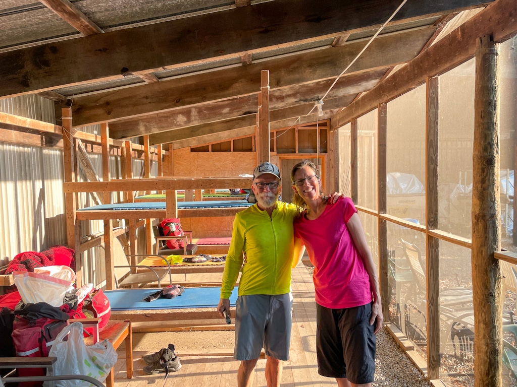
I ended the day in Hancock at the C&O Bike Shop. In their shop yard they have built an old fashioned bunkhouse (think Cool Hand Luke) for cyclists to spend the night as they ride along the trail. For $15 you get a wooden bunk bed (bring your own pad), a hot shower with a towel, a place to plug in your electronics and a porta-potty. As the lady who checked me in said, “there are no chocolates on your pillow”. It was bring your own pillow too! The best part about the accommodations was that there were three others in the bunkhouse. An active military officer doing a three day trip and a married couple, who were also from Colorado, Scott and Sarah were in their last few days of the three month trip from Astoria Oregon to Washington D.C. on their tandem. It was really fun to sit around and swap similar stories. Hats off to them! What a big trip!
Day 28. Hancock MD to Antietam Creek Campground near Sharpsburg, MD. 57 miles
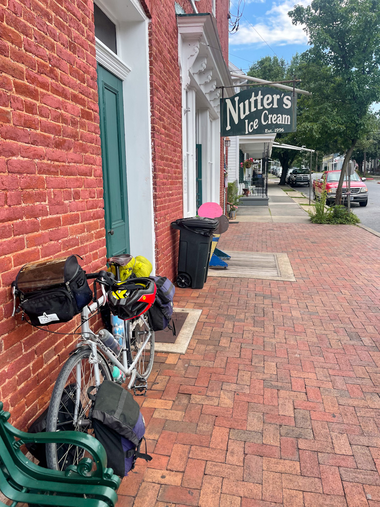
The path was in good shape in this area and I made good time. I had lunch in Williamsport and enjoyed my ride next to the Potomac River. The Potomac is a shallow river and in many areas it’s rocky. There were a number of small dams along the way which made some areas which were navigable by boats for short stretches. These areas were busy with RV campgrounds, motor boats and jet ski’s. Before I camped I needed to do some shopping for dinner so I took a detour up to Sharpsburg. It was a cute little town and it gets extra points with me because it had the best ice cream parlor that I found along my entire journey. At Nutters Ice Cream I got two good sized scoops in a cone for less than $3. Eating it kept me busy for quite some time and I enjoyed watching the steady stream of traffic going into the old time store.
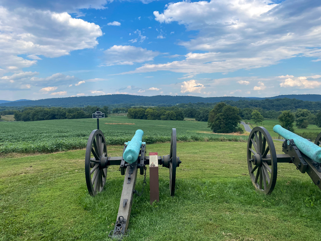
Sharpsburg is also known for being at the Antietam Battlefield. This is notorious for being the single most deadly battle in the history of the United States. During 12 hours on September 17, 1862 23,000 soldiers from both sides were either killed, wounded or missing. It was a turning point in the war and ended the Confederate Army’s invasion of the north. I rode by a portion of the battlefield and it’s hard to imagine this happening on, what is now, a peaceful field. I camped down near the river at Antietam Creek and was kept awake by the giggles on 12 year old girls at a birthday party. Kudos to the brave Mom who took them camping!
Day 29 Antietam Creek Campground to Horsepen Branch Campsite. 48 Miles
I could have made it all the way to Washington D.C. today, but I decided to arrive earlier in the day on Sunday. That would give me two easy days, an early arrival and one less night at a hotel. I knew I didn’t have very long to cycle and my legs felt like they could take the day off. My first stop was at Harpers Ferry. A key location in the Civil War and a tourist destination today. It’s an intersection. It’s where the Potomac and the Shenandoah Rivers come together, it’s where the Appalachian Trail crosses the C&O Trail and it’s where Maryland, Virginia and West Virginia come together. I hoisted my bike up a bunch of stairs, walked across the bridge and had a look around, had some breakfast and charged my phone. When camping multiple days in a row it’s hard to keep everything charged. I took a sandwich to go and headed downstream.
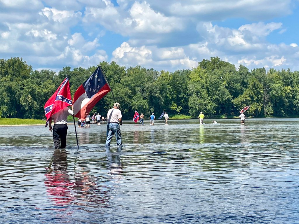
As I was looking for a good place to eat my sandwich I saw a group of people walking down the path in front of me. As I said “passing on the left” I noticed that some of them were carrying flags, confederate flags among others. As I passed slowly I asked a man “If you don’t mind me asking, can you tell me what your walk is about today?” He answered “Just up the river a little bit is a shallow spot in the river and that is the point where the Confederate Army first crossed into the north from Virginia. This is the anniversary and we celebrate it each year by crossing the river just as they did.” I thanked him and rode on. Just ahead I saw a path off toward the river and decided to take my sandwich to the shore of the river. I was hoping that they would be crossing in the general area so I could watch. It turned out that I had picked their spot. They didn’t seem to mind me and I watched, quietly eating my sandwich and taking a few discrete photos. I had a view of something that you don’t see from the interstate and a glimpse into a side of America that I don’t have much exposure to. I must say that it was an eye opener for this Colorado boy.
Day 30 Into Washington DC 27 miles
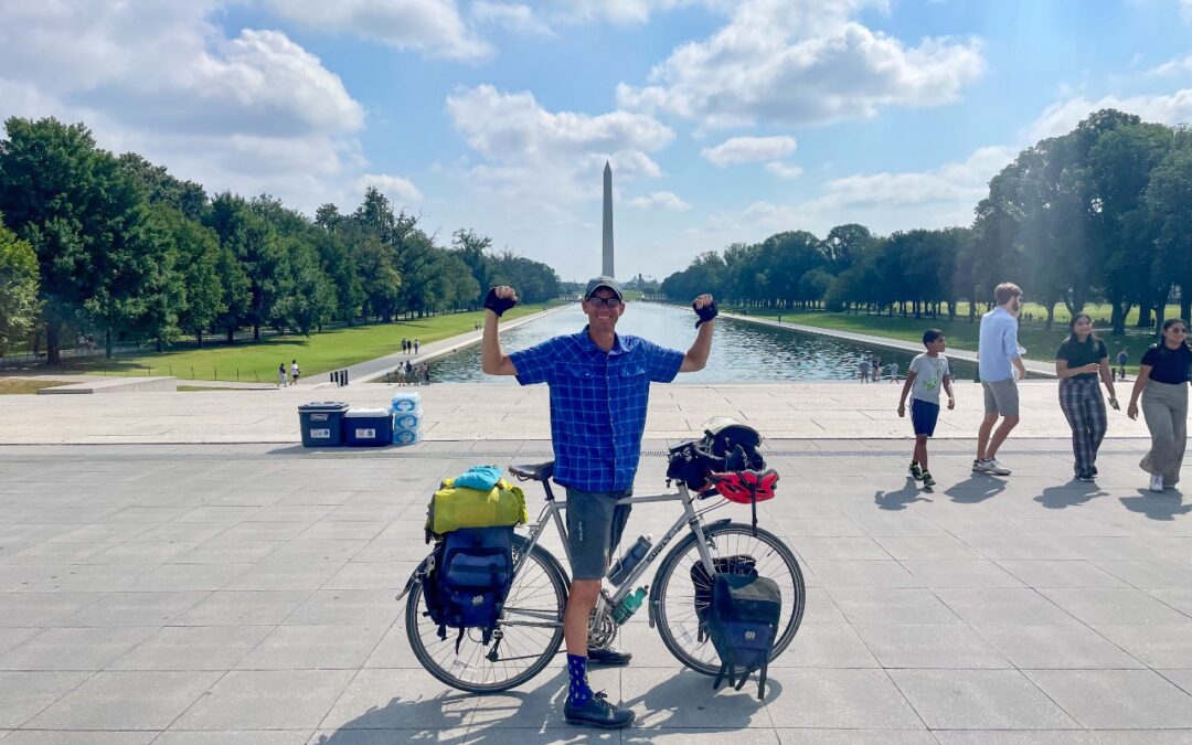
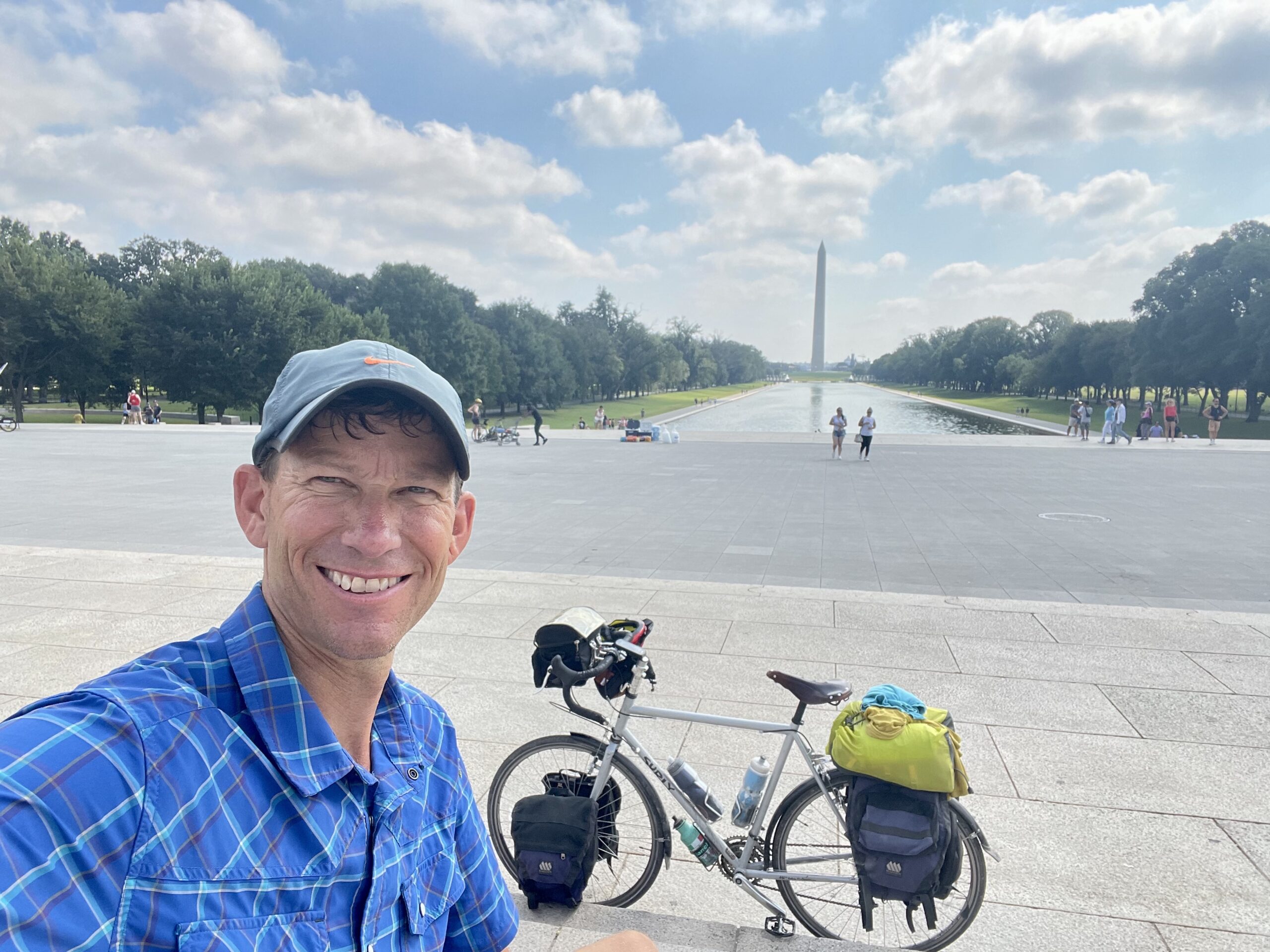
I set out fairly early and took my time. The C&O trail goes right into the city, so all I needed to do was follow it in. As I got closer to my destination the path became busier and busier. Being on the road and the recent trails had been a mainly solitary pursuit. Early on I had gone days without seeing another biker. But today I saw thousands and wound my way all the way to mile “0” of the C&O which was the entry lock off of the Potomac. I took a picture there, left a note for Scott and Sarah and then rode over to the Lincoln Memorial and reflecting pool to take a few more photos. But then the necessities of bike travel took over, I needed to charge my phone and I needed something to eat.
I rode around a bit more and at 12:30 I went to my hotel near Union Station and the Capitol to see when I might be able to check in. More welcome words were never heard “your room is ready Mr. Kearney, I can check you in now.” I took a nice hot shower and promptly took a needed two hour nap. I had been “on” for 30 straight days and I was ready for some rest.
In all I had ridden 1,936 miles in 30 days. I had been in nine states plus the District of Columbia.
0 Comments